Elliott & LA Meetings
Smack bang in the middle of the Northern Territory, along the Stuart Highway, lays the small township of Elliott. LA Meetings are subject to change, so please call the Area Manager to check dates.

“Since we got local government there have always been Aboriginal people on the council. They have special links into the community and they see both sides of the story. I think they have shown the way toward black and white people doing things together. We have worked together to achieve a very good compromise arrangement, by consent, whereby native title has been granted to more than 80% of the land in Elliott. That has helped confirm the recognition of Elliott as a place that has rich mythological significance for Aboriginal people. At the same time, European heritage has been recognised with the heritage listing of Newcastle Waters town, and that has now become a major visitor attraction.” Councillor Bob Bagnall, 2010
The traditional name for the township of Elliott is Kulumindini. It is the country of the Jingili desert people with the Wambaya people to the east and south-east; the Yangman and Mangarrayi to the north; the Mudbura and Gurindji to the west and the Warlpiri, Warlmanpa and Warramungu to the south and south-west. These people all had traditional associations with the Jingili and ceremonial ties to the watered areas around Elliott. The lands around Elliott lie across the important Dreaming tracks of the Emu and the Sun, spirit ancestors who were travelling through country on their way to the southern parts of the Northern Territory. The rocks found in this area are amongst the oldest in central Australia, some over 1900 million years old.
The explorations of John McDouall Stuart who traversed the centre of Australia from south to north in the mid 1880s opened up the Northern Territory to white settlement. Yet, it was the decision to build the Overland Telegraph Line from 1870-1872 which gave the modern Northern Territory a reason to exist. Along with telegraph stations at Alice Springs, Tennant Creek, Katherine and Darwin one was situated at Powell Creek, about 60km south of Elliott. Elliott itself did not come into existence until 1942.
History: Elliott is the Barkly region’s second largest town and sits on the edge of Newcastle Waters Station. Named after Army Captain Reginald Douglas Elliott (MBE), it began life at the site of Number 8 bore as an Australian Army Camp during World War II (1942). A war memorial statue stands on the site of the camp, directly adjacent to the bore used to supply water to troops.
Its population is largely Aboriginal, who live in two outstations at either end of the town – Gurungu (North Camp) and Wilyuku (South Camp). Gurungu was formed in 1968 when workers left Newcastle Station following a dispute and Wilyuku started in the 1970s when people left the Barkly Tablelands after award wages were brought in.
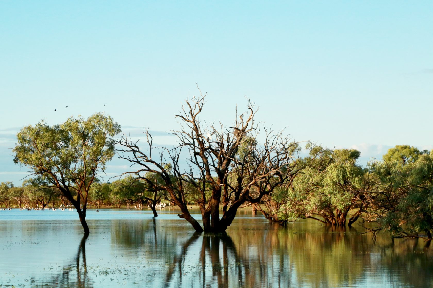
Local attractions: Nearby Lake Woods was once part of a huge freshwater basin, which dried up in the last Ice Age, around 23,000 years ago. During this period, the lake reduced in size from 5000 square km to its current 420 square km. Longreach Waterhole forms part of this lake and is an important breeding ground for many inland bird species and popular with tourists.
Newcastle Waters: Located just 25km north of Elliott and 3km in from the highway, remnants of this historic town stand as a museum and memorial to the life of the outback drovers.
Services: Barkly Regional Council service centre and workshop yards to service the communities of Wilyuku, Gurungu and Marlinja outstation, sport and recreation centre, aged care services, safe house, police station, BP, art centre, play group, library, post office, Elliott School, caravan park and community store.
Infrastructure: Aged Care Vehicle, Tractor Purchase, November 2013 –landfill completion; December 2015 - Elliott Water park launched.